Useful Links
- Review of the Statistical Classification and Delineation of Settlements
- Settlement 2015 Guidance Document
- Settlement 2015 Look up Table
- Further 2011 Census information for Settlements
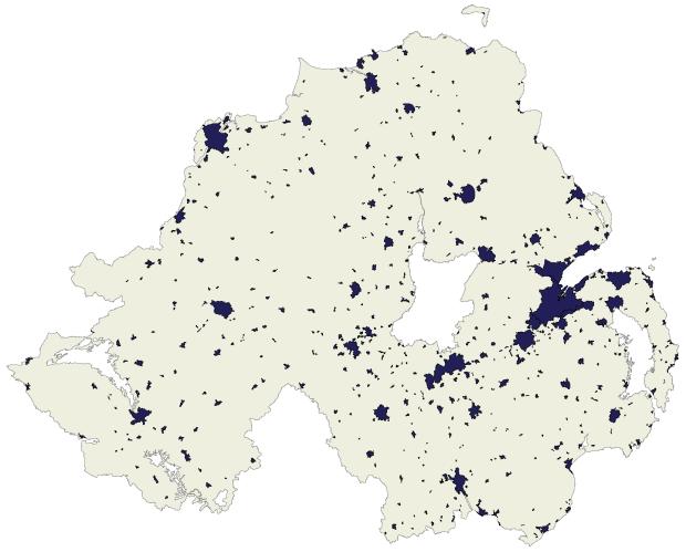
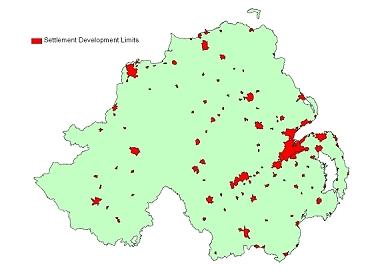
Settlement Development Limits (2015)
Settlement Development Limits (SDLs) are a statistical classification and delineation of settlements in Northern Ireland defined by the DOE Planning Service in November 2014. SDL boundaries are available for settlements exceeding the thresholds of 20 or more households and 50 or more usual residents.
Attribute Table
| Code | Settlement Coding Convention |
|---|---|
| Name | Settlement name |
| Band | Settlement band |
| DT_20MIN | Indicator of whether a settlement is within a 20 min drive-time of a service provision location |
| DT_30MIN | Indicator of whether a settlement is within a 30 min drive-time of a service provision location |
| UR_ex | 2011 census count of usual residents for each settlement polygon |
| OccHH_ex | 2011 census count of occupied households for each settlement polygon |
| UR-ap | 2011 Census count if usual residents for each approximated settlement polygon (approximated by aggregates of 100m grid squares) |
| OccHH_ap | 2011 Census count if occupied households for each approximated settlement polygon (approximated by aggregates of 100m grid squares) |
Settlement Development Limits (2005)
Settlement Development Limits (SDLs) are a statistical classification and delineation of settlements in Northern Ireland defined by the Planning Service. SDL boundaries are available for settlements with a population of greater than 1,000. Further information is available in the Report of the Inter-Departmental Urban-Rural Definition Group.
Attribute Table
| Location | Name of Settlement |
|---|---|
| LGD | Local Government District |
| Band_name | Statistical classification band name as defined by the Planning service |
| Band | Statistical classification label |
| Pop_2001 | Settlement population count |
| Hsce_2001 | Settlement household count |
| Geoarea_ha | Area settlement in hectares |
| Easting | Geographic centroid easting |
| Northing | Geographic centroid nothing |