Overview
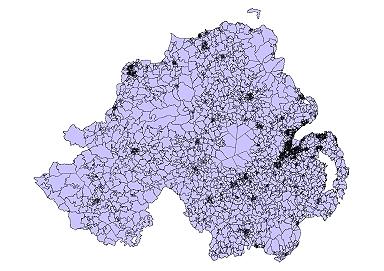
Output Areas (OAs) nest within the 582 Electoral Wards in Northern Ireland and were designed to have similar population sizes of around 125 households and 350 people, they are also as socially similar as possible. There are 5022 OAs in Northern Ireland.
Output Areas (OAs) do not nest within the new 11 Local Government Districts (LGD2014) but a best-fit lookup table has been created. Technical guidance document and look-up tables are available.
Geography preview

Attribute table
| Variable | Description |
|---|---|
| X_Popcoord* | Geographic coordinate easting for population-weighted centroid |
| Y_Popcoord* | Geographic coordinate northing for population-weighted centroid |
| Hectares | Area in hectares |
| X_Coord | Geographic coordinate easting for geographically weighted centroid |
| Y_Coord | Geographic coordinate northing for geographically weighted centroid |
| OA_Code | Output Area coding convention |