- 1km Grid Squares
- 100m Grid Squares
- Combined 1km and 100m Grid Squares
Irish Grid and Grid Square references
Grid Squares are made up of a system of squares defined by two lines at right angles to each other. The first, called the easting, is an east to west line that runs parallel to the central meridian while the second, called the northing, runs at right angles to it. Grid Squares are zero referenced at the far southwest of Ireland and both the easting and northing are calibrated in metres.
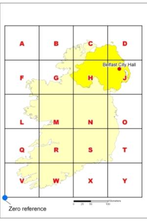
The area of Ireland is divided into 20 squares, measuring 100km by 100km, each identified by a single letter.
Grid Square references are made up of a combination of the easting and northing and consist of a letter and an even number of digits. The letter designates one of the twenty 100km squares that cover Ireland, as shown by the map above. The remaining numbers represent a point within that 100km square by giving the distance east and north from the bottom southwest corner of the square. The numbers can vary in number of digits depending upon the resolution of the grid reference.
For example: Belfast City Hall has an easting 333831 and northing 374015 which means it is 333831 metres east and 374015 metres north of the bottom southwest corner. This puts it in 100km square J. The distance from the southwest corner of square J is 33 831 metres east and 74 015 metres north. The grid reference of the City Hall is thus J 33 74 to a 1km resolution and J 338 740 to a 100m resolution.
Grid Squares used for the Grid Square products
The Grid Squares used for the Grid Square products use this grid reference to refer to the area enclosed by a square projected from that grid reference by the distance that the resolution of the grid reference dictates. Thus a Grid Square with reference J 33 74 extends 1km east and 1km north from that point while the Grid Square with reference J 338 740 extends 100m east and 100m north.
Grid Square references for a point location

For example: Belfast City Hall has an easting 333831 and northing 374015 which means it is 333831 metres east and 374015 metres north of the bottom southwest corner. The Giants Causeway has an easting 294724 and northing 444769 which means it is 294724 metres east and 444769 metres north of the bottom south west corner. Finally, Enniskillen Castle has an easting 223141 and a northing 344221.
1km Grid Square
The 1km Grid Square product is a 1km Grid Square layer and is available to download from 1km Grid Square in GIS format. The attribute table contains the Grid Square reference (GSQ21_1km).
100m Grid Square
The 100m Grid Square product is a 100m Grid Square layer and is available to download from 100m Grid Square in GIS format. The attribute table contains the Grid Square reference (GSQ21_100m).
Combined Grid Square
The Combined Grid Square product is a combined 1km and 100m Grid Square layer and is available to download from Combined Grid Square in GIS format.
The combined product is mainly made up of 1km grids but where a settlement exists (based on the Settlement Development Limits) as used for the 2015 Review of the Statistical Classification and Delineation of Settlements) with a population of 1,000 usual residents or more (based on Census 2021) a 100m grid resolution is provided.
The attribute table contains the Grid Square references (GSQ21_100m and GSQ21_1km) and a grid type indicator (100m or 1km).

Creation of Combined Grid Square product
In larger settlements, 100m grids replace 1km grids to give greater resolution of population and household statistics.
The settlement development limits (SDLs) used were those as defined by the 2015 Review of the Statistical Classification and Delineation of Settlements and those having a usual resident population of 1,000 or more in Census 2021.
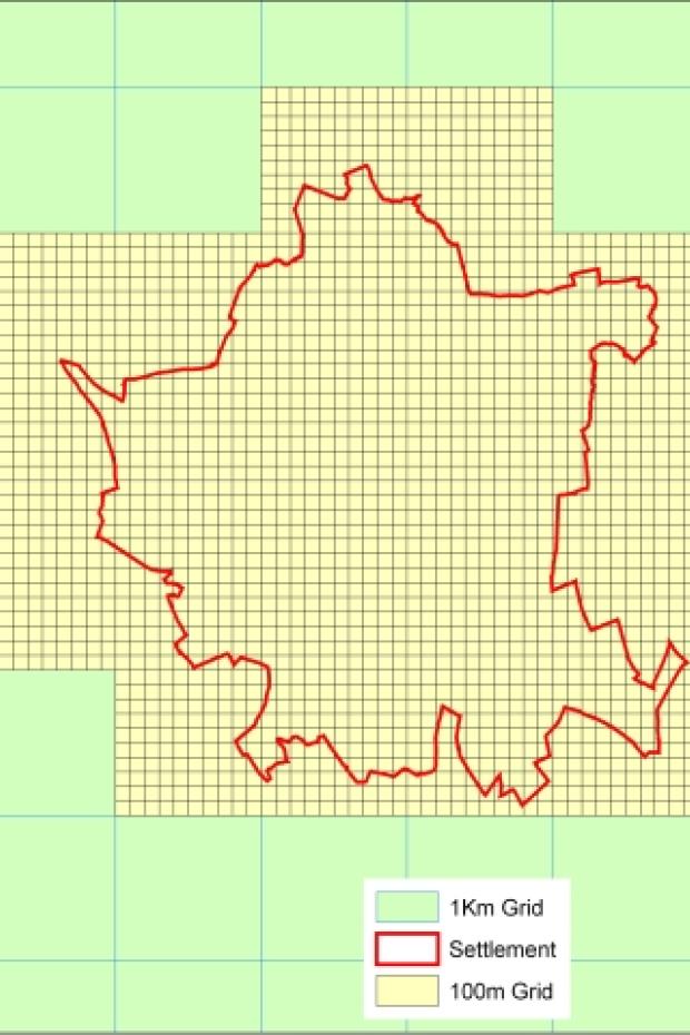
Images outline the various stages in creating the combined 100m and 1km Grid Square file.
Stage 1
Settlement Development Limits and 1km Grid Squares are used to determine the creation of 100m Grid Squares.
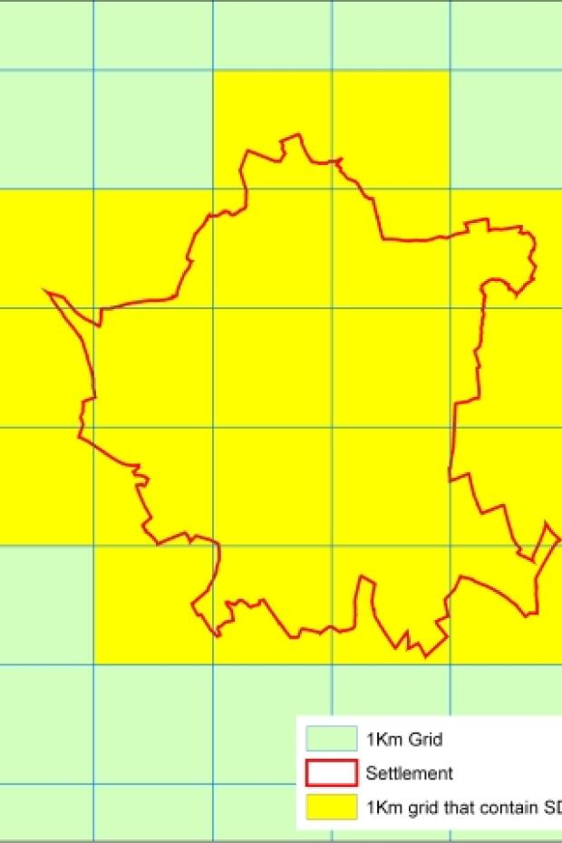
Stage 2
1km Grid Squares that contain part or all of a Settlement Development Limit are replaced by one hundred 100m Grid Squares.
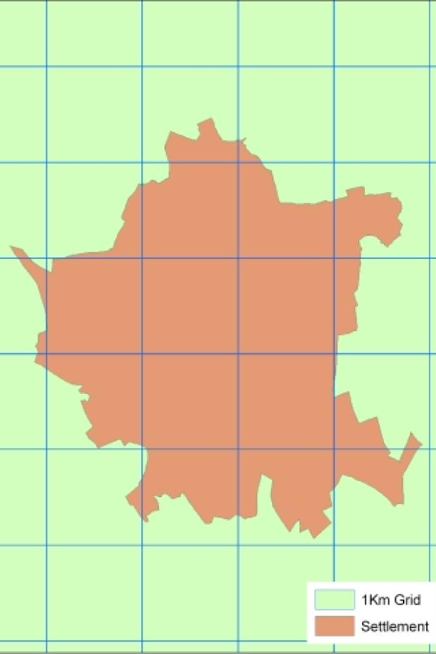
Stage 3
100m Grid Squares replace whole 1km grids for 144 settlements in Northern Ireland.